
Mountain weather
Bannau Brycheiniog / Brecon Beacons Mountain weather forecast table
Confidence
High confidence throughout, though some uncertainty with extent of fog patches early Sunday morning.
Mountain weather hazards
Hazards apply at or above 300m, reflecting the more severe conditions which can occur at altitude.
 Strong Sunlight
Harmful UV levels from sunlight increase with altitude giving a greater risk of sunburn and eye damage, even on some overcast days. On breezy days, the cooling effect of wind on exposed skin may disguise any feeling of sunburn until it is too late. If there is snow cover, glare increases the effect of UV rays especially on the eyes. It is advisable to wear sun block, protective clothing such as a long-sleeved top and hat and have good quality eye protection.
Mountain weather forecast
A fine and dry day, with sunny spells.
| Time | 06:00 | 09:00 | 12:00 | 15:00 | 18:00 | 21:00 |
|---|---|---|---|---|---|---|
Weather (at 600m) |
|
|
|
|
|
|
Chance of precipitation (at 600m) |
<05% | <05% | <05% | <05% | <05% | <05% |
Wind direction and speed (mph)
Altitude above mean sea level
| Time | 06:00 | 09:00 | 12:00 | 15:00 | 18:00 | 21:00 |
|---|---|---|---|---|---|---|
| 600m |
N
3
|
NE
5
|
N
4
|
N
5
|
E
6
|
E
6
|
| 300m |
SW
3
|
NE
3
|
N
3
|
N
4
|
NE
5
|
NE
4
|
| Valley |
SW
3
|
NE
2
|
N
3
|
N
4
|
NE
5
|
NE
3
|
Wind gust (mph)
Altitude above mean sea level
| Time | 06:00 | 09:00 | 12:00 | 15:00 | 18:00 | 21:00 |
|---|---|---|---|---|---|---|
| 600m | 6 | 7 | 7 | 8 | 9 | 10 |
| 300m | 4 | 5 | 5 | 7 | 10 | 11 |
| Valley | 4 | 3 | 5 | 7 | 10 | 11 |
Altitude above mean sea level
| Time | 06:00 | 09:00 | 12:00 | 15:00 | 18:00 | 21:00 |
|---|---|---|---|---|---|---|
| 600m |
4°
|
6°
|
8°
|
9°
|
8°
|
6°
|
| 300m |
4°
|
9°
|
11°
|
12°
|
11°
|
7°
|
| Valley |
4°
|
10°
|
12°
|
13°
|
11°
|
8°
|
| Freezing Level |
1,100m
|
1,100m
|
1,200m
|
1,200m
|
1,300m
|
1,200m
|
Altitude above mean sea level
| Time | 06:00 | 09:00 | 12:00 | 15:00 | 18:00 | 21:00 |
|---|---|---|---|---|---|---|
| 600m |
2°
|
4°
|
6°
|
8°
|
6°
|
4°
|
| 300m |
3°
|
8°
|
11°
|
11°
|
10°
|
6°
|
| Valley |
3°
|
10°
|
12°
|
12°
|
10°
|
7°
|
Additional weather information
Meteorologist's view
Despite the sunshine and moderate UV levels, the feels like temperature will start and end the day close to freezing on the summits, so extra layers may be needed if stopping for a length of time.
Weather
Chilly to start, with a patchy frost and some fog. This quickly clearing to leave a fine day, with plenty of sunny spells, though cloud increasing later.
Chance of cloud-free hill tops
95%
Low cloud and visibility
Mist and fog patches may lift briefly to low cloud around 200-400m before clearing. Otherwise excellent visibility is expected throughout. Locally very poor first thing in any fog patches.
Recent rainfall
Location: Neuadd (Near Pontsticill)
Altitude: 353m
| Last 24 hours | Last 48 hours | Last 72 hours |
|---|---|---|
| 1.2mm | 8.8mm | 11.8mm |
Measurement date:
Rainfall data provided by Natural Resources Wales. The Met Office is not responsible for content provided by third parties and may remove this data without warning.
Mountain weather information
Weather
Early morning mist and fog patches clearing to a largely fine day, with sunny spells. A very low chance of the odd light shower developing my mid-afternoon.
Chance of cloud-free hill tops
100% throughout.
Maximum wind speed expected
Northeasterly 5-10 mph gusting 15 mph.
Temperature
- At 600m Zero Celsius, rising to plus 7 Celsius.
- Valley Plus 3 Celsius, rising to plus 14 Celsius.
- Freezing level Above the summits.
Low cloud and visibility
Mist and fog patches may lift briefly to low cloud around 200-300m before clearing. Otherwise excellent visibility is expected throughout. Locally very poor first thing in any fog patches. Locally moderate visibility in any passing light showers.
Mountain weather information
Tue 21 Apr
Sunrise:
Sunset:
A cloudy morning, with some hill fog. Clouds lifting and breaking by the afternoon, with some sunshine possible, but also an isolated light shower. A brisk northeasterly wind developing, making it feel rather cold on the summits.
Wed 22 Apr
Sunrise:
Sunset:
Early mist clearing to leave a sunny day, with a strong and gusty easterly wind.
Thu 23 Apr
Sunrise:
Sunset:
Staying sunny, with a gusty easterly wind making it feel colder than the temperature suggests.
Updated at:
Summit specific forecast
Mountain summit forecast map
Loading map…
Key
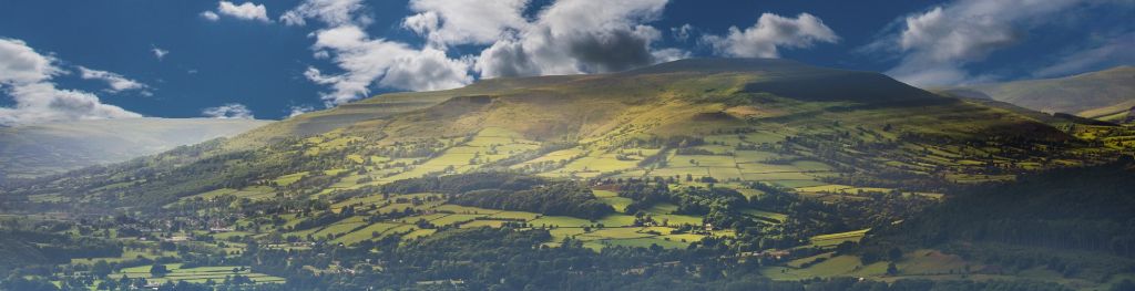
The Bannau Brycheiniog / Brecon Beacons is a mountain range in South Wales comprising six main peaks, with the highest peak, Pen y Fan, standing at 886 metres.