
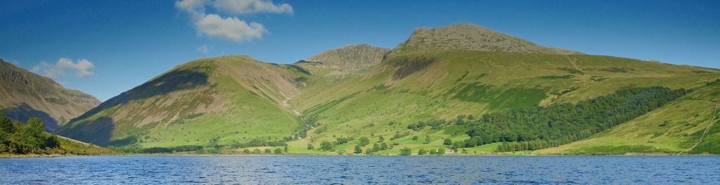
Mountain weather
Lake District Mountain weather forecast table
Confidence
High for high pressure controlling the pattern and bringing settled weather, but lower for the cloud detail.
Mountain weather hazards
Hazards apply at or above 300m, reflecting the more severe conditions which can occur at altitude.
 Strong Sunlight
Harmful UV levels from sunlight increase with altitude giving a greater risk of sunburn and eye damage, even on some overcast days. On breezy days, the cooling effect of wind on exposed skin may disguise any feeling of sunburn until it is too late. If there is snow cover, glare increases the effect of UV rays especially on the eyes. It is advisable to wear sun block, protective clothing such as a long-sleeved top and hat and have good quality eye protection.
Severe Chill Effect
Wind significantly lowers the ‘feels-like’ temperature relative to the actual temperature, with even moderate winds significantly adding to the chilling effect. Strong winds can result in a severe and debilitating wind chill many degrees below the actual temperature. This effect will be enhanced in rain or wet snow. Without protection, prolonged exposure could result in frost nip or frostbite on exposed parts of the body and/or hypothermia.
Poor Visibility
Poor visibility presents challenging route finding conditions. Visibility could be significantly less than 50 metres in all directions with few or no visual references, especially on featureless moors or plateaux. Distances become hard to judge and cliff or cornice edges can be difficult to recognise. These conditions require good navigational skills. There is a risk of white-out conditions when mist or fog is combined with extensive snow cover.
Mountain weather forecast
Dry with sunny spells. Strong summit winds.
| Time | 06:00 | 09:00 | 12:00 | 15:00 | 18:00 | 21:00 |
|---|---|---|---|---|---|---|
Weather (at 800m) |
|
|
|
|
|
|
Chance of precipitation (at 800m) |
<05% | <05% | 00% | 00% | 00% | 00% |
Wind direction and speed (mph)
Altitude above mean sea level
| Time | 06:00 | 09:00 | 12:00 | 15:00 | 18:00 | 21:00 |
|---|---|---|---|---|---|---|
| 900m |
E
45
|
E
35
|
E
26
|
E
28
|
E
31
|
E
32
|
| 600m |
E
24
|
E
22
|
E
21
|
E
23
|
E
23
|
E
27
|
| 300m |
NE
4
|
E
6
|
E
11
|
E
11
|
E
7
|
E
5
|
| Valley |
NE
7
|
NE
8
|
E
11
|
E
10
|
NE
6
|
NE
5
|
Wind gust (mph)
Altitude above mean sea level
| Time | 06:00 | 09:00 | 12:00 | 15:00 | 18:00 | 21:00 |
|---|---|---|---|---|---|---|
| 900m | 51 | 42 | 33 | 35 | 38 | 41 |
| 600m | 31 | 28 | 28 | 31 | 32 | 40 |
| 300m | 25 | 21 | 24 | 25 | 22 | 22 |
| Valley | 22 | 19 | 22 | 21 | 13 | 15 |
Altitude above mean sea level
| Time | 06:00 | 09:00 | 12:00 | 15:00 | 18:00 | 21:00 |
|---|---|---|---|---|---|---|
| 900m |
2°
|
2°
|
4°
|
5°
|
4°
|
5°
|
| 600m |
2°
|
5°
|
7°
|
8°
|
6°
|
4°
|
| 300m |
4°
|
8°
|
11°
|
12°
|
9°
|
6°
|
| Valley |
7°
|
10°
|
13°
|
14°
|
12°
|
9°
|
| Freezing Level |
700m
|
900m
|
1,100m
|
1,200m
|
1,200m
|
1,000m
|
Altitude above mean sea level
| Time | 06:00 | 09:00 | 12:00 | 15:00 | 18:00 | 21:00 |
|---|---|---|---|---|---|---|
| 900m |
-7°
|
-6°
|
-2°
|
0°
|
-3°
|
-1°
|
| 600m |
-4°
|
-1°
|
3°
|
4°
|
1°
|
-2°
|
| 300m |
2°
|
7°
|
9°
|
10°
|
7°
|
4°
|
| Valley |
5°
|
8°
|
11°
|
12°
|
11°
|
8°
|
Additional weather information
Meteorologist's view
Severe wind chill at height, particularly early in lower freezing level. Significant risk of sunburn.
Weather
Staying dry with good clear then sunny spells, these most widespread across the west of the park.
Chance of cloud-free hill tops
90% plus
Low cloud and visibility
Good or very good becoming very poor within cloud which occasionally appears at 800m in the east.
Ground conditions
No recent ground conditions report available.
Mountain weather information
Weather
Dry with good periods of sunshine. Fresh summit winds.
Chance of cloud-free hill tops
90% plus
Maximum wind speed expected
East or southeast 15-20mph
Temperature
- At 800m Plus 3 Celsius increasing 12 Celsius for the afternoon
- Valley Plus 3 Celsius increasing 18 Celsius for the afternoon
- Freezing level 900m soon lifting above summits
Low cloud and visibility
Good or very good, becoming very poor in cloud which infrequently lowers to 800m.
Mountain weather information
Fri 24 Apr
Sunrise:
Sunset:
Dry and sunny with light winds. Freezing level above the peaks.
Sat 25 Apr
Sunrise:
Sunset:
Dry and sunny with light winds. Freezing level above the peaks.
Sun 26 Apr
Sunrise:
Sunset:
Mainly dry with sunny spells and moderate southwest winds. Freezing level above the peaks.
Updated at:
Summit specific forecast
Mountain summit forecast map
Loading map…
Key
The Lake District covers an area of 885 square miles with its highest point, Scafell Pike, standing at 978 metres.