
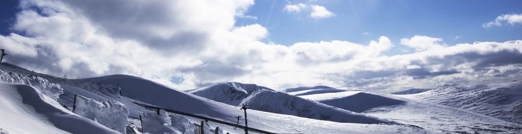
Mountain weather
South Grampian and Southeast Highlands Mountain weather forecast table
Confidence
High for unsettled weather through Tuesday before changing to dry and settled conditions from midweek onwards.
Mountain weather hazards
Hazards apply at or above 300m, reflecting the more severe conditions which can occur at altitude.
 Gales
Gales
Gale force winds (gusts over 50mph) make walking difficult and strenuous with a potential to be blown over by gusts. There is often a marked increase in winds through cols or on exposed ridges and summits. Distances can take longer to cover and compass bearings become harder to follow accurately.
Poor Visibility
Poor visibility presents challenging route finding conditions. Visibility could be significantly less than 50 metres in all directions with few or no visual references, especially on featureless moors or plateaux. Distances become hard to judge and cliff or cornice edges can be difficult to recognise. These conditions require good navigational skills. There is a risk of white-out conditions when mist or fog is combined with extensive snow cover.
Storm Force Winds
Storm force winds (gusts over 70mph) make walking very strenuous with any mobility virtually impossible over exposed ground. Where these conditions occur there is a high risk of being blown over and even standing may be impossible at times with a risk of being blown off one’s feet. Basic tasks such as using a map, eating, putting on extra clothing or communication become extremely difficult away from any shelter.
Severe Chill Effect
Wind significantly lowers the ‘feels-like’ temperature relative to the actual temperature, with even moderate winds significantly adding to the chilling effect. Strong winds can result in a severe and debilitating wind chill many degrees below the actual temperature. This effect will be enhanced in rain or wet snow. Without protection, prolonged exposure could result in frost nip or frostbite on exposed parts of the body and/or hypothermia.
Heavy Persistent Rain
Heavy and persistent rain can lead to drenched clothing and footwear with waterproofs often becoming soaked through, especially if accompanied by strong winds. This can lead to significant loss of body heat and an increased likelihood of hypothermia. Terrain may turn increasingly boggy underfoot while streams can flood and become impassable. There may also be a risk of flooding in valleys or glens. If there is snow cover, a heightened avalanche hazard is possible and avalanche reports should be consulted where available.

Mountain weather forecast
Cloudy with heavy rain arriving later. Gale to storm force winds.
| Time | 06:00 | 09:00 | 12:00 | 15:00 | 18:00 | 21:00 |
|---|---|---|---|---|---|---|
Weather (at 800m) |
|
|
|
|
|
|
Chance of precipitation (at 800m) |
20% | 30% | 20% | 20% | 70% | 60% |
Wind direction and speed (mph)
Altitude above mean sea level
| Time | 06:00 | 09:00 | 12:00 | 15:00 | 18:00 | 21:00 |
|---|---|---|---|---|---|---|
| 1100m |
SW
65
|
SW
64
|
SW
59
|
S
52
|
S
51
|
SW
46
|
| 900m |
SW
43
|
SW
43
|
SW
40
|
S
36
|
S
34
|
SW
30
|
| 600m |
SW
24
|
SW
26
|
SW
24
|
SW
22
|
S
20
|
SW
17
|
| 300m |
SW
16
|
SW
18
|
SW
18
|
SW
16
|
SW
14
|
SW
12
|
| Glen |
SW
14
|
SW
16
|
SW
17
|
SW
17
|
SW
15
|
SW
11
|
Wind gust (mph)
Altitude above mean sea level
| Time | 06:00 | 09:00 | 12:00 | 15:00 | 18:00 | 21:00 |
|---|---|---|---|---|---|---|
| 1100m | 75 | 74 | 71 | 64 | 62 | 57 |
| 900m | 54 | 53 | 53 | 48 | 45 | 41 |
| 600m | 45 | 47 | 45 | 41 | 38 | 33 |
| 300m | 36 | 41 | 39 | 34 | 31 | 27 |
| Glen | 31 | 35 | 36 | 35 | 32 | 26 |
Altitude above mean sea level
| Time | 06:00 | 09:00 | 12:00 | 15:00 | 18:00 | 21:00 |
|---|---|---|---|---|---|---|
| 1100m |
3°
|
2°
|
2°
|
2°
|
2°
|
2°
|
| 900m |
5°
|
4°
|
4°
|
4°
|
4°
|
4°
|
| 600m |
7°
|
6°
|
6°
|
7°
|
6°
|
6°
|
| 300m |
9°
|
10°
|
10°
|
10°
|
9°
|
8°
|
| Glen |
10°
|
10°
|
11°
|
11°
|
10°
|
9°
|
| Freezing Level |
1,700m
|
1,700m
|
1,600m
|
1,700m
|
1,800m
|
1,700m
|
Altitude above mean sea level
| Time | 06:00 | 09:00 | 12:00 | 15:00 | 18:00 | 21:00 |
|---|---|---|---|---|---|---|
| 1100m |
-7°
|
-7°
|
-8°
|
-7°
|
-7°
|
-7°
|
| 900m |
-3°
|
-3°
|
-3°
|
-3°
|
-3°
|
-3°
|
| 600m |
2°
|
1°
|
1°
|
2°
|
1°
|
1°
|
| 300m |
6°
|
6°
|
7°
|
7°
|
6°
|
6°
|
| Glen |
7°
|
7°
|
8°
|
8°
|
7°
|
6°
|
Additional weather information
Met Office Aberdeen meteorologist's view
Strong to gale or storm force winds will make for strenuous walking and risk of being blown over. Low cloud and poor visibility may make for tricky navigation. Cold on higher routes.
Weather
Cloudy through the morning and afternoon with outbreaks of patchy light rain and drizzle. In the evening a band of heavier rain spreads southeastwards. Strong to gale force winds may reach storm force on highest summits.
Chance of cloud-free hill tops
20%
Low cloud and visibility
Low cloud with base 500-700m for much of the day, falling to lower slopes in heavy rain later. Visibility poor in cloud and rain, otherwise good.
Mountain weather information
Weather
Low cloud and rain clearing to the southeast through the early morning to leave the rest of the day dry with mainly high level cloud and some bright or sunny spells developing. Strong southwesterly winds easing to light to moderate northwesterlies by the end of the day.
Chance of cloud-free hill tops
20%, soon becoming 100% in the morning.
Maximum wind speed expected
Southwest 30-35mph gusting 40-45mph, easing north 10-15mph gusting 15-20mph.
Temperature
- At 800m Plus 3 to 5 Celsius.
- Glen Plus 8 Celsius rising to 12 Celsius during the day.
- Freezing level Above summits falling to 1000m.
Low cloud and visibility
Low cloud with base 600-800m at first but soon rising above summits. Visibility very good, poor in cloud at first.
Mountain weather information
Thu 19 Mar
Sunrise:
Sunset:
High pressure becoming in charge so a dry and settled day with sunny spells and light to moderate winds. Freezing level around 1000m.
Fri 20 Mar
Sunrise:
Sunset:
Dry with sunny spells and light winds. Freezing level 1200m.
Sat 21 Mar
Sunrise:
Sunset:
A continuation of dry and settled conditions with light winds.
Updated at:
Summit specific forecast
Mountain summit forecast map
Loading map…
Key
Including South and East Cairngorms National Park, Aberdeenshire and Angus Hills, Ben Vrackie, Ben Lawers, Loch Tay and Ochils
For snow and avalanche hazard forecasts please visit Scottish Avalanche Information Service